
Utrecht
180 known cemeteries in Utrecht, Netherlands.
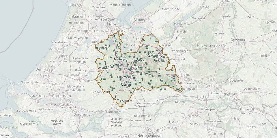 © OpenStreetMap
- Oudewater Protestant CemeteryGPS coordinates: 52.02077° N, 4.87625° E
- Oudewater Roman Catholic CemeteryGPS coordinates: 52.02032° N, 4.87684° E
- Oud Leusden Municipal CemeteryGPS coordinates: 52.13118° N, 5.37186° E
- Oud Wulven CemeteryGPS coordinates: 52.04253° N, 5.15453° E
- Oud-Zuilen CemeteryGPS coordinates: 52.13261° N, 5.06852° E
- Polsbroek ChurchGPS coordinates: 51.97557° N, 4.84874° E
- Prattenburg Natural Burial GroundGPS coordinates: 52.01320° N, 5.52480° E
- Prinses Ireneweg General CemeteryGPS coordinates: 52.02932° N, 5.16820° E
- Protestantse DorpskerkGPS coordinates: 52.10420° N, 5.18170° E
- Renswoude General CemeteryGPS coordinates: 52.07242° N, 5.52969° E
- Rhenen General CemeteryGPS coordinates: 51.96147° N, 5.57522° E
- Rhenen Jewish CemeteryGPS coordinates: 51.96607° N, 5.57213° E
- Rijnhof General CemeteryGPS coordinates: 52.09700° N, 4.90247° E
- Schalkwijk ChurchyardGPS coordinates: 51.99460° N, 5.18380° E
- Sint-Barbarakerk CemeteryGPS coordinates: 52.06627° N, 5.20507° E
- Sint-Jozefkerk Roman Catholic CemeteryGPS coordinates: 52.13786° N, 5.49602° E
- Sisters of St. Joseph Cemetery, AmersfoortGPS coordinates: 52.15279° N, 5.35033° E
- Soestbergen First General Cemetery, UtrechtGPS coordinates: 52.07712° N, 5.12972° E
- Soesterberg CemeteryGPS coordinates: 52.10925° N, 5.28826° E
- Soesterkwartier CemeteryGPS coordinates: 52.15751° N, 5.36899° E
- Soest General CemeteryGPS coordinates: 52.17127° N, 5.30743° E
- St. Barbara Cemetery, NieuwegeinGPS coordinates: 52.00716° N, 5.09493° E
- Steenstraat Jewish CemeteryGPS coordinates: 51.97575° N, 5.34322° E
- St. Joseph Roman Catholic Parish Churchyard, LeusdenGPS coordinates: 52.13275° N, 5.42887° E
- St Michaelkerk De Bilt CemeteryGPS coordinates: 52.10428° N, 5.17035° E
- Tienhoven CemeteryGPS coordinates: 52.17120° N, 5.08000° E
- 't Spijck Cemetery, HarmelenGPS coordinates: 52.10056° N, 4.97331° E
- Tull en 't Waal Dutch Reformed ChurchyardGPS coordinates: 52.00162° N, 5.13289° E
- Utrecht Daelwijck CemeteryGPS coordinates: 52.12853° N, 5.09427° E
- Utrecht Jewish CemeteryGPS coordinates: 52.10952° N, 5.10585° E