
Greater Manchester
226 known cemeteries in Greater Manchester, United Kingdom.
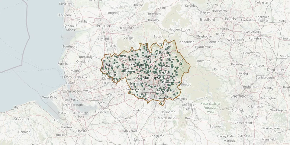 © OpenStreetMap
- Stockport Cemetery And CrematoriumGPS coordinates: 53.39791° N, 2.15114° W
- Dukinfield CemeteryGPS coordinates: 53.48711° N, 2.08456° W
- Tyldesley CemeteryGPS coordinates: 53.51152° N, 2.44495° W
- St Peters ChurchyardGPS coordinates: 53.59128° N, 2.46600° W
- Holy Trinity ChurchyardGPS coordinates: 53.59923° N, 2.53833° W
- St Matthew ChurchyardGPS coordinates: 53.56261° N, 2.37322° W
- St. Luke's ChurchyardGPS coordinates: 53.47521° N, 2.58058° W
- St Wilfrid ChurchyardGPS coordinates: 53.58682° N, 2.66165° W
- Westhoughton CemeteryGPS coordinates: 53.54934° N, 2.52594° W
- Willow Grove CemeteryGPS coordinates: 53.42529° N, 2.15081° W
- Hyde CemeteryGPS coordinates: 53.44379° N, 2.06841° W
- Lowton Saint Mary Parish ChurchGPS coordinates: 53.47630° N, 2.55120° W
- Rochdale CemeteryGPS coordinates: 53.61473° N, 2.18428° W
- Philips Park CemeteryGPS coordinates: 53.49062° N, 2.19509° W
- Hindley CemeteryGPS coordinates: 53.54079° N, 2.56456° W
- Mottram CemeteryGPS coordinates: 53.45464° N, 2.00869° W
- Ashton CemeteryGPS coordinates: 53.50068° N, 2.07069° W
- Gidlow CemeteryGPS coordinates: 53.56812° N, 2.64371° W
- Atherton CemeteryGPS coordinates: 53.52188° N, 2.50303° W
- Tonge CemeteryGPS coordinates: 53.57666° N, 2.40837° W
- Cheadle CemeteryGPS coordinates: 53.39276° N, 2.20547° W
- Greenacres CemeteryGPS coordinates: 53.54359° N, 2.07923° W
- Heaton CemeteryGPS coordinates: 53.57576° N, 2.45864° W
- Gorton CemeteryGPS coordinates: 53.45522° N, 2.16343° W
- Sale Brooklands CemeteryGPS coordinates: 53.41800° N, 2.32793° W
- Droylsden CemeteryGPS coordinates: 53.48449° N, 2.15391° W
- Leigh (Saint Paul) ChurchyardGPS coordinates: 53.51492° N, 2.52801° W
- Leigh CemeteryGPS coordinates: 53.49342° N, 2.48071° W
- Saddleworth Parish Council CemeteryGPS coordinates: 53.55208° N, 1.99252° W
- Southern CemeteryGPS coordinates: 53.42893° N, 2.25916° W